Back Scie (suba) CEB Scie German Scie (fleuve) French Seda Latin Сі (річка) Ukrainian 锡河 (滨海塞纳省) Chinese
| Scie | |
|---|---|
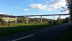
 The Scie at Dénestanville, looking upstream. | |
| Native name | La Scie (French) |
| Location | |
| Country | France |
| Physical characteristics | |
| Source | |
| • location | Pays de Caux |
| • elevation | 140 m (460 ft) |
| Mouth | |
• location | English Channel |
• coordinates | 49°55′5″N 1°1′54″E / 49.91806°N 1.03167°E |
| Length | 38 km (24 mi) |
| Basin size | 217 km2 (84 sq mi) |
| Discharge | |
| • average | 1.8 m3/s (64 cu ft/s) |
The Scie (French pronunciation: [si]) is a river that flows from the plateau of the southern Pays de Caux in the Seine-Maritime département of Normandy into the English Channel. It is 38 km (24 mi) long.[1]
The river rises at Saint-Victor-l'Abbaye and passes through Auffay, Saint-Maclou-de-Folleville, Longueville-sur-Scie, Anneville-sur-Scie, Heugleville-sur-Scie, Saint-Aubin-sur-Scie and finally Hautot-sur-Mer.

