Back مقاطعة سنيكا (أوهايو) Arabic سنکا بؤلگهسی، اوهایو AZB Seneca County, Ohio BAR Сенека (окръг, Охайо) Bulgarian সেনেকা কাউন্টি, ওহাইও BPY Seneca Gông (Ohio) CDO Seneca County (kondado sa Tinipong Bansa, Ohio) CEB Seneca County, Ohio Welsh Seneca County (Ohio) Danish Seneca County (Ohio) German
41°08′N 83°08′W / 41.13°N 83.13°W
Seneca County | |
|---|---|
 | |
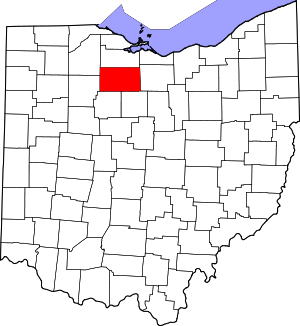
 Location within the U.S. state of Ohio | |
 Ohio's location within the U.S. | |
| Coordinates: 41°08′N 83°08′W / 41.13°N 83.13°W | |
| Country | |
| State | |
| Founded | April 1, 1824 |
| Named for | the Seneca nation |
| Seat | Tiffin |
| Largest city | Tiffin |
| Area | |
| • Total | 553 sq mi (1,430 km2) |
| • Land | 551 sq mi (1,430 km2) |
| • Water | 1.8 sq mi (5 km2) 0.3% |
| Population (2020) | |
| • Total | 55,069 |
| • Density | 100/sq mi (40/km2) |
| Time zone | UTC−5 (Eastern) |
| • Summer (DST) | UTC−4 (EDT) |
| Congressional district | 5th |
| Website | senecacountyohio |
Seneca County is a county located in the northwestern part of the U.S. state of Ohio. As of the 2020 census, the population was 55,069.[1] Its county seat is Tiffin.[2] The county was created in 1820 and organized in 1824.[3] It is named for the Seneca Indians, the westernmost nation of the Iroquois Confederacy. This people were based in present-day New York but had territory extending into Pennsylvania and Ohio.[4] Seneca County comprises the Tiffin, OH Micropolitan Statistical Area, which is also included in the Findlay–Tiffin, OH Combined Statistical Area.
- ^ 2020 census
- ^ "Find a County". National Association of Counties. Retrieved June 7, 2011.
- ^ "Ohio: Individual County Chronologies". Ohio Atlas of Historical County Boundaries. The Newberry Library. 2007. Archived from the original on April 6, 2016. Retrieved February 14, 2015.
- ^ Cite error: The named reference
osuedcwas invoked but never defined (see the help page).

