Back ترنهوت Arabic Тьорнхаут Bulgarian Turnhout Breton Turnhout Catalan Turnhout (parokya) CEB Turnhout Czech Turnhout German Τούρνχαουτ Greek Turnhout Esperanto Turnhout Spanish
This article needs additional citations for verification. (September 2015) |
Turnhout | |
|---|---|
 Grote Markt | |
| Coordinates: 51°19′N 04°57′E / 51.317°N 4.950°E | |
| Country | |
| Community | Flemish Community |
| Region | Flemish Region |
| Province | Antwerp |
| Arrondissement | Turnhout |
| Government | |
| • Mayor | Paul Van Miert (N-VA) |
| • Governing party/ies | N-VA, CD&V, Vooruit, Groen |
| Area | |
| • Total | 56.71 km2 (21.90 sq mi) |
| Population (2018-01-01)[1] | |
| • Total | 44,136 |
| • Density | 780/km2 (2,000/sq mi) |
| Postal codes | 2300 |
| NIS code | 13040 |
| Area codes | 014 |
| Website | www.turnhout.be |
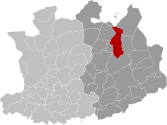
Turnhout (Dutch pronunciation: [ˈtʏr(ə)nɦʌut]) is a Belgian municipality and city located in the Flemish province of Antwerp. The municipality comprises only the city of Turnhout proper. In 2021, its population was 45,874.[2] The total area is 56.06 km2 (21.64 sq mi).[3] The agglomeration is much more populous, with 81,473 inhabitants.[4] It is known for its playing card industry, and houses the head office of the world's largest manufacturer of playing cards, Cartamundi. Turnhout is also the capital of the administrative district with the same name. The city council often promotes the city as "the capital of the Kempen area". This designation is entirely unofficial, since the Kempen area is far larger than the Turnhout district and does not form an administrative unit.
Turnhout serves as the economic and cultural center for other communities in the immediate vicinity with more than 40 schools. There is also an important services sector with two hospitals, a two-stage theatre, an eight-screen cinema and one of the largest cultural centres of Belgium.
Turnhout is located at about 51.3 North and 4.9 East, 42 km (26 mi) from the centre of Antwerp, 30 km (19 mi) from Breda and Tilburg, 40 km (25 mi) from Eindhoven. The football club of the city is K.V. Turnhout.
- ^ Statbel, Wikidata Q12480
- ^ "Bevolking per statistische sector - Sector 13040". Statistics Belgium. Retrieved 10 May 2022.
- ^ "Belgium: Major Cities and Municipalities - Population Statistics, Maps, Charts, Weather and Web Information".
- ^ "Agglomerations (Belgium): Urban Agglomerations - Population Statistics, Charts and Map".


